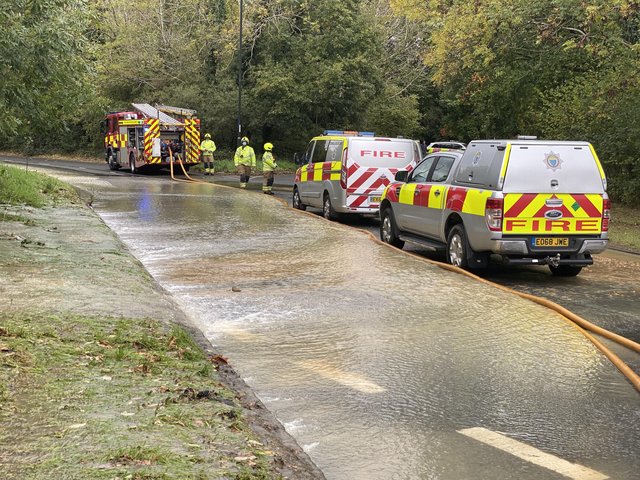
Flooding in Crawley

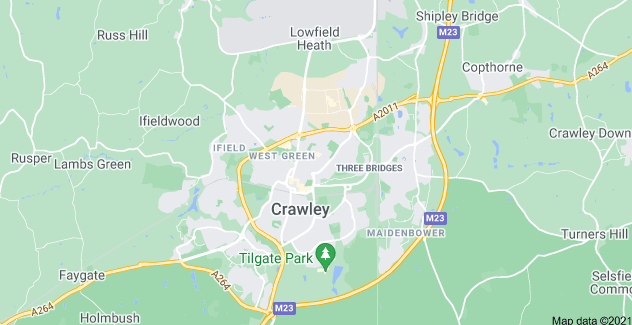
Crawley is a large town and borough in West Sussex, England. It is 28 miles south of London, 18 miles north of Brighton and Hove, and 32 miles north-east of the county town of Chichester. Crawley covers an area of 17.36 square miles and had a population of 106,597 at the time of the 2011 Census.

The town contains 14 residential neighbourhoods radiating out from the core of the old market town, and separated by main roads and railway lines. The nearby communities of Ifield, Pound Hill and Three Bridges were absorbed into the new town at various stages in its development. In 2009, expansion was being planned in the west and north-west of the town, in cooperation with Horsham District Council, which has now become a new neighbourhood named Kilnwood Vale, but it is not in Crawley.[3] Economically, the town has developed into the main centre of industry and employment between London and the south coast. Its large industrial area supports manufacturing and service companies, many of them connected with the airport. The commercial and retail sectors continue to expand.[2]
Incidents in Crawley

To stay up to date on reports and warnings for flooding in Crawley, look for Crawley flood warnings on gov.uk.

The Crawley Observer reported on a road that had flooded due to a burst watermain in October 2020. Nearly 20 homes were flooded due to the incident.

West Sussex Fire and Rescue Service warned motorists to avoid Horsham Road and the Cheals roundabout area, as fire crews dealt with the incident.

The fire service added at least 17 homes were flooded as a result of today’s incident.

Click to read the full article on The Crawley Observer site.

The Crawley Observer also reported on an investment that Crawley is set to receive. 

Over 1,400 more homes and businesses in Crawley are to be better protected from flooding by 2026-27, as part of new plans published by the Government alongside a £5.2 billion investment.

Click to read the full article on The Crawley Observer site.

Crawley Borough is divided into 15 wards, each of which is represented by either 2 or 3 councillors. A map of the wards is available on the council’s website.

Councillors are elected for terms of four years. Elections are staggered: only one third of the 37 seats are contested at each election. Results of the latest election can be found on the council’s website.

Crawley Borough Council - Flooding Advice

Crawley council has a page you can visit if you want advice on flooding. For more information, click to visit Crawley Council's "Severe Weather and Flooding" page.

Flooding

Most flooding in Crawley is due to the volume of water going into streams and rivers after persistent heavy rain. If you are affected by flooding, you can contact emergency flooding contacts. 

We’re not responsible for maintenance or clearance of pipes where water passes underground, this is the responsibility of your sewage removal company (find name on your water bill).

Flood advice

The Environment Agency offers practical advice for coping with floods, and minimising the damage that flood water can cause. They also offer a flood map of the UK, so you can see if your home is at risk of flooding. 


We’re responsible for keeping any open ditches, culverts or rivers clear of obstructions, in parks and open spaces. If you see a blocked ditch or river, report it to us.


News

TOP