Courtesy of hertfordshiremercury.co.uk Heavy rainfall has seen roads flooded all over the count...
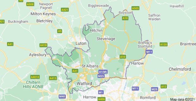
Hertfordshire (/ˈhɑːtfədʃɪə/ (About this soundlisten); often abbreviated Herts) is one of the home counties in southern England. It is bordered by Bedfordshire and Cambridgeshire to the north, Essex to the east, Greater London to the south, and Buckinghamshire to the west. For government statistical purposes, it is placed in the East of England region. It covers 634 square miles (1,640 km2). It derives its name from a hart (stag) and a ford, used as the components of the county's coat of arms and of the flag. Hertfordshire County Council is based in Hertford, once the main market town.
Elevations are higher in the north and west, reaching more than 800 feet (240 m) in the Chilterns near Tring. The county centres on the headwaters and upper valleys of the rivers Lea and the Colne; both flow south, and both are accompanied by a canal. Hertfordshire's undeveloped land is mainly agricultural and much is protected by green belt. The largest sector of the county's economy is services. Hertfordshire is well-served with motorways and railways for access to London, the Midlands and the North.